Disclaimer

Deep Carbon Cycle is no longer an active organization or initiative. This website serves solely as a historical reference and archive of its previous research, projects, and contributions to the field. The information provided here reflects the work done during its active years, but the project is no longer operational.

Melting Temperature of Earth’s Mantle Depends on Water

A joint study between Carnegie and the Woods Hole Oceanographic Institution has determined that the average temperature of Earth’s mantle beneath ocean basins was about 110 degrees Fahrenheit (60 Celsius) higher than previously thought, due to water present in deep minerals. The results are published in Science.

Earth’s mantle, the layer just beneath the crust, was the source of most of the magma that erupts at volcanoes. Minerals that make up the mantle contain small amounts of water, not as a liquid, but as individual molecules in the mineral’s atomic structure.  Mid-ocean ridges, volcanic undersea mountain ranges, are formed when these mantle minerals exceed their melting point, become partially molten, and produce magma that ascends to the surface. As the magmas cool, they form basalt, the most-common rock on Earth and the basis of oceanic crust. In these oceanic ridges, basalt can be three to four miles thick.

Studying these undersea ranges can teach scientists about what was happening in the mantle, and about the Earth’s subsurface geochemistry.

One longstanding question has been a measurement of what’s called the mantle’s potential temperature. Potential temperature was a quantification of the average temperature of a dynamic system if every part of it were theoretically brought to the same pressure. Determining the potential temperature of a mantle system allows scientists better to understand flow pathways and conductivity beneath the Earth’s crust. The potential temperature of an area of the mantle can be more closely estimated by knowing the melting point of the mantle rocks that eventually erupt as magma and then cool to form the oceanic crust.

In damp conditions, the melting point of peridotite, which melts to form the bulk of mid-ocean ridge basalts, was dramatically lower than in dry conditions, regardless of pressure. This means that the depth at which the mantle rocks start to melt and well up to the surface will be different if the peridotite contains water, and beneath the oceanic crust, the upper mantle was thought to contain small amounts of water—between 50 and 200 parts per million in the minerals of mantle rock.

So lead author Emily Sarafian of Woods Hole, Carnegie’s Erik Hauri, and their team set out to use lab experiments in order to determine the melting point of peridotite under mantle-like pressures in the presence of known amounts of water.

“Small amounts of water have a big effect on melting temperature, and this was the first time experiments have ever been conducted to determine precisely how the mantle’s melting temperature depends on such small amounts of water,” Hauri said.

They found that the potential temperature of the mantle beneath the oceanic crust was hotter than had previously been estimated.

“These results may change our understanding of the mantle’s viscosity and how it influences some tectonic plate movements,” Sarafian added.

The study’s other co-authors are Glenn Gaetani and Adam Sarafian, also of Woods Hole.

This research was funded by the National Science Foundation and the Woods Hole Oceanographic Institution’s Deep Ocean Exploration Institute.

Live Blog: Trail by Fire 1.5 expedition to South America

The atmosphere that allows our planet to sustain life formed from gases emitted by volcanoes early in Earth’s history. These volatile elements are constantly recycled back into the deep Earth at subduction zones, where tectonic plates sink into the mantle. During this process the sinking plate was subjected to increasing heat and pressure, and releases volatiles. These volatiles, once added to the mantle, induce melting and fuel volcanic explosions, completing the cycle. While this depiction of the earth’s giant recycling factory was well established conceptually, they do not know how efficient it is. They can estimate how much goes in, but have little idea what proportion was released back to the atmosphere, and what proportion remains trapped at depth. This question was crucial if they want to understand how our atmosphere formed and our planet became able to sustain life. In the present-day context, characterizing how much gas comes out of the giant recycling factory was also key to understanding volcanic effects on climate, volcanic emissions being significant – but poorly constrained – parameters in current climate models..

Their team of early career volcanologists was conducting expeditions to the South American Andes. Their objective was to provide the first accurate and large-scale estimate of the flux of volatile species (H2O, H2, CO2, CO, SO2, H2S, HCl, HF, and more) emitted by volcanoes of the Nazca subduction zone. The journey was taking us across half a continent, from the giant volcanoes of Ecuador through the altiplanoes of Peru and to the Southern tip of Chile, traveling on some of the Earth’s highest roads, and climbing some of the Earth’s tallest volcanoes.

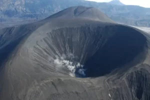
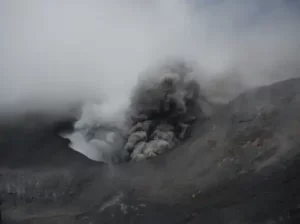
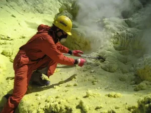
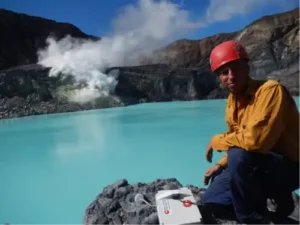
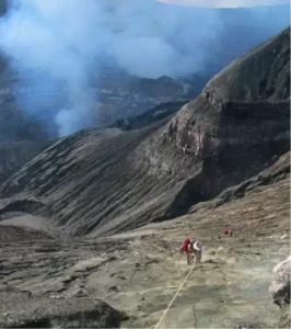
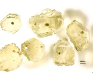
Deep Mantle Chemistry Surprise: Carbon Content not Uniform

Even though carbon was one of the most abundant elements on Earth, it was actually very difficult to determine how much of it exists below the surface in Earth’s interior.

Research by Deep Carbon Observatory scientists Marion Le Voyer, Erik Hauri (Carnegie Institution for Science, USA), Katherine Kelley (University of Rhode Island, USA) and Elizabeth Cottrell (Smithsonian Institution, USA) has doubled the world’s known finds of mantle carbon. Their findings, based on analyses of crystals containing mantle magma samples, are published in Nature Communications.

Overall, there was a lot about carbon chemistry that takes place below Earth’s crust that scientists still don’t understand. In particular, the amount of carbon in the Earth’s mantle has been the subject of hot debate for decades. This topic was of interest because the amount of carbon present in the mantle underpins our planet’s geological processes, including triggering volcanic activity and sustaining the biosphere. It also affects our atmosphere when carbon dioxide gas was released by eruptions; volcanic eruptions played a large role in pre-historic climate variations.

But it’s difficult to measure the amount of carbon that exists below the Earth’s surface. Scientists can study the igneous rocks that formed when mantle melts, called magma, rose to the surface, erupted as lava, and hardened again to create a rock that was called basalt. However, the process of ascent and eruption releases almost all the magma’s carbon as carbon dioxide gas, which makes the erupted basaltic rocks poor indicators of the amount of carbon that was in the magmas from which they formed.

“This is how explosive eruptions happen,” Hauri explained. “The sudden catastrophic loss of gas that, before the eruption, was dissolved into the magma at high pressure, but during eruption has nowhere else to go, leaving no post-eruption trace in the hardened basalt of the amount carbon once present.”

But Le Voyer, Hauri, and their team analyzed some basalt samples from the equatorial mid-Atlantic ridge that contained previously unstudied tiny magmatic inclusions, small pockets of pure magma that were completely trapped inside solid crystals that protected them from degassing during magma ascent and eruption. Analysis showed that these inclusions had trapped their original carbon content before being erupted on the seafloor.

“This is only the second time that samples of magma containing their original carbon content have ever been found and analyzed, doubling our knowledge of the region’s carbon chemistry,” Hauri said.

The very first samples containing their original carbon were also revealed at Carnegie, by Hauri and Brown University professor Alberto Saal, in 2002. Those samples came from the Pacific seafloor. Comparison of the data for these two samples revealed that the mantle’s carbon content was much less uniform than scientists had previously predicted, varying by as much as two orders of magnitude in different parts of the mantle.

“Our discovery that mantle carbon has a more complex distribution than previously thought has many implications for how mantle processes may vary by location,” added Le Voyer, who conducted this research as a postdoc at Carnegie and was now at the University of Maryland.

Measuring Volcanic Eruptions from Space: Uniting Geophysical and Geochemical Data

When volcanoes erupt, they spew lava, ash, and gas into the atmosphere and over the surrounding landscape. The impacts of volcanic eruptions in populated areas are well documented, since scientists can monitor gas emissions and collect physical samples with relative ease. However, a significant fraction of Earth’s volcanoes are remote, making direct observation challenging.

Some researchers have therefore turned to space-based techniques, collecting data from satellites. In a new paper published in the journal Nature Communications, DCO collaborators Brendan McCormick Kilbride, Marie Edmonds (both at the University of Cambridge, UK), and Juliet Biggs (University of Bristol, UK), analyzed several sets of satellite data in order to reconcile, for the first time, geophysical and geochemical models of magma composition [1].

“We’ve known for some time that when many volcanoes erupt we see a change in elevation, like the volcano has deflated, and we can measure this change using satellite observations,” said Edmonds, co-Chair of DCO’s Reservoirs and Fluxes Community. “We also know that volcanic eruptions produce gas plumes rich in sulfur dioxide, which we can also measure from space. However, what’s been a bit of a mystery is how these two datasets fit together. We couldn’t spot a pattern.”

By measuring how much a volcano deforms throughout an eruption, scientists can make an estimate of the volume of material previously contained within the magma chamber. These measurements, however, were at odds with the mass of sulfur dioxide measured in the erupted gas plume.

“We were seeing way more sulfur dioxide than we would expect for the volume of materials expelled during an eruption,” said first author McCormick.

The team therefore began modeling what was going on beneath the surface. They found that if more gases like sulfur dioxide and carbon dioxide are present in magma, they change its physical properties. Magmas with high concentrations of these volatiles are not homogenous. Instead, the gases clump together, creating bubbles. These bubbly, spongy magmas are a lot more compressible than magmas without bubbles, partially explaining why many large eruptions rich in sulfur dioxide show only limited changes in ground deformation.

The authors also suggest that in eruptions with huge gas emissions, a fraction of pure gas could collect at the top of the magma chamber prior to eruption making the ratio of erupted gas to eruption volume even larger.

“What we’ve done here is build a model of volcanic eruptions that could explain several aspects of volatile rich magmas,” added McCormick. “We’ve shown that our model is consistent with several datasets. If we can confirm this relationship between sulfur dioxide output and eruption volume, we come closer to being able to use satellite data alone to investigate some of Earth’s most remote volcanoes.”

“These data also tell us a lot about the Earth system,” added Edmonds. “As we refine our model, and integrate data from DCO’s DECADE volcano monitoring stations, we’ll generate a much more accurate picture of deep volatile cycles, including the deep carbon cycle.”

High-Frequency Gas Monitoring Reveals Carbon Dioxide Precursor to Eruptions at Turrialba Volcano

Turrialba volcano had deposited ash on the capital city of Costa Rica and its 3 million inhabitants numerous times since 2014.

In a new article in the Journal of Geophysical Research and an online Earthchem database, a DCO-DECADE team led by Maarten de Moor (National University, Costa Rica) and Alessandro Aiuppa (Palermo University, Italy) tracked changes in gas composition and flux from 2014 to present [1,2]. The near-continuous and high-frequency gas monitoring time series (Multi-GAS and scanning DOAS stations) reveal a volcano in a state of extreme turmoil, posing an increasing threat to local lives and livelihoods.

During the monitoring time period the deployed instruments recorded large changes in gas composition and flux. Carbon dioxide to sulfur ratios show significant variations with notable peaks that occur weeks to days before eruptive episodes. The precursory spikes in carbon dioxide are the result of pulses of deep magma injected into the volcanic system. These rising magma bodies are directly responsible for the timing and magnitude of Turrialba’s eruptive periods. The hydrogen sulfide to sulfur dioxide ratio also displays remarkable changes over two orders of magnitude during the monitoring period, from constituting a major component of the bulk gas early in the time series to being undetectable by the Multi-GAS station. The disappearance of detectable H2S in the gas emissions indicates the progressive boiling off of what must be an enormous hydrothermal system as magma intrusions invade the volcanic edifice, and a transition to purely magmatic gas compositions.

Perhaps most interesting for understanding the deep carbon cycle, the authors’ estimations of CO2 flux from Turrialba suggest the most voluminous release of carbon dioxide did not occur at the same time as magma intrusion. Rather, they saw the release of huge amounts of CO2 well after the first magma intrusion event, an observation also associated with high H2S emissions. This suggests that a major proportion of COreleased over the three-year period was actually hydrothermal in origin, with deeply derived CO2 stored in the hydrothermal system for an indeterminate amount of time and then released into the atmosphere during energetic explosions.

Decompression degassing modelling and analysis of the CO2-SO2-H2S-H2O system allowed the authors to estimate magma depth. The long time series of SO2 emission rate allowed them to calculate the total volume of magma intruded since the beginning of Turrialba’s unrest. Importantly, the large variations in both gas composition and CO2 flux highlight the need for continuous gas monitoring to define the carbon budget of convergent margins. These results once again show the potential power of high-frequency gas monitoring for forecasting eruptions.

DCO DECADE Team Head to Papua New Guinea to Measure Volcanic Carbon Degassing

An international team of scientists was traveling to the islands of Papua New Guinea this September to study degassing from active volcanoes in remote jungles there.

An international team of scientists was traveling to the islands of Papua New Guinea this September to study degassing from active volcanoes in remote jungles there. Some of these volcanoes are among the most active on Earth, ejecting a significant proportion of global volcanic gases into the atmosphere. The team, led by DCO DECADE (DEep CArbon DEgassing) scientist Brendan McCormick (University of Cambridge, UK) and supported by DCO and NERC COMET (the UK’s National Environment Research Council Centre for Observation and Modelling of Earthquakes, Volcanoes and Tectonics), will trek through uncharted volcanic lands to deploy novel ground- and unmanned aerial vehicle-based instrumentation at target volcanoes including Rabaul, Ulawan, Pago, and Garbuna volcanoes on the island of New Britain, and Bagana volcano on Bougainville. Working in close collaboration with Rabaul Volcano Observatory, the team, which also includes Roberto D’Aleo (Università degli Studi di Palermo, Italy), Peter Barry (University of Oxford, UK), Lois Salem (University of Cambridge, UK), and Bo Galle, Santiago Arellano, and Julia Wallius (all at Chalmers University of Technology, Sweden), aims to provide the first detailed measurements of carbon degassing from the region.

You can follow the team during the expedition using @pngvolc16 or #pngvolc16 on Twitter, Instagram, and Facebook. On Saturday, 27 August 2016, team member Lois Salem will appear on Soho Radio London in their Science Mixtape show at 10-11AM (GMT+1).


Exhaling Earth: Scientists Closer to Forecasting Volcanic Eruptions

New app shows intimate ties between volcanoes and earthquakes and gives open access to 50+ years of data on quakes, eruptions, and related emissions.

On average, 40 volcanoes on land erupt into the atmosphere each month, while scores of others on the seafloor erupt into the ocean. A new time-lapse animation uniting volcanoes, earthquakes, and gaseous emissions reveals unforgettably the large, rigid plates that make the outermost shell of Earth and suggests the immense heat and energy beneath them seeking to escape.

With one click, visitors can see the last 50 years of “Eruptions, Earthquakes, and Emissions.” Called E3, the app allows the viewer to select and learn about individual eruptions, emissions, and earthquakes as well as their collective impact. Visualizing these huge global datasets together for the first time, users can speed or slow or stop the passage of time. They can observe flat maps or globes, and watch gas clouds circle the planet. Data from Smithsonian’s Global Volcanism Program and the United States Geological Survey (USGS) feed into the app, and the datasets are available for free download. The app will update continuously, accumulating new events and additional historical information as it becomes available.

“Have you had a ‘eureka!’ moment where you suddenly see order in what appeared chaotic? This app abounds in such moments,” said Elizabeth Cottrell, head of the Global Volcanism Program of the Smithsonian Institution in Washington, DC. “As geologic events accumulate over time, Earth’s tectonic plates appear before your eyes. What took geologists more than 200 years to learn, a viewer learns in seconds. We wanted to share the excitement with as big an audience as possible. This is the first time we’re able to present these datasets together for the public.”

She added, “This app is interesting not only for educators and the public, but also will help scientists understand global eruption patterns and linkages between Earth’s inner workings and the air we breathe.”

A team of experts developed the app with support from the Smithsonian Institution and the Deep Carbon Observatory, an international multidisciplinary research program exploring the quantities, movements, forms, and origins of carbon deep inside Earth. Deep Carbon Observatory scientists are studying volcanic emissions as part of this mission, and will more than triple the number of permanent volcano gas monitoring stations from 2012–2019.

Tracking volcanic emissions to avoid disaster

Hundreds of millions of people around the world live on the flanks of active volcanoes, and eruptions can cause massive economic damage even when few people live nearby. In 2010, Eyafjallajökull erupted in Iceland, spewing massive ash clouds, disrupting air travel for millions of people and costing the airline industry nearly USD 2 billion. Better anticipation of eruptions could lower the human and economic toll of these natural phenomena.

Recent discoveries by Deep Carbon Observatory (DCO) scientists in the Deep Earth Carbon Degassing (DECADE) initiative are laying the foundation for improved volcanic eruption forecasts. These hard-won advances required expensive, dangerous expeditions to sniff gas emissions for clues.

“We are deploying automated monitoring stations at volcanoes around the world to measure the gases they emit,” said Tobias Fischer, a volcanologist at the University of New Mexico, USA, and leader of DECADE. “We measure carbon dioxide, sulfur dioxide, and water vapor (steam), the major gases emitted by all volcanoes on the planet. In the hours before an eruption, we see consistent changes in the amount of carbon dioxide emitted relative to sulfur dioxide. Keeping an eye on the ratios globally via satellites and on-site monitoring helps us learn the precursors of volcanic eruptions. Monitoring these volcanic gas variations also helps us come up with a more accurate estimate of total volcanic carbon dioxide emissions on Earth—a major goal of DCO.”

“Our goal of tripling the number of volcanoes monitored around the world by 2019 is no small task,” added Fischer. “Installing instruments on top of volcanoes is dangerous work in extremely hard-to-reach places.”

“Sometimes our monitoring stations become victims of eruptions they are trying to measure, as happened recently on Villarrica volcano in Chile. At least our instruments recorded gas composition changes right up until the eruption destroyed them,” Fischer noted.

By 2019, DECADE scientists hope to have gas monitoring stations on 15 of the world’s 150 most active volcanoes. This will add to the eight stations currently operated by other entities such as the USGS and the University of Palermo (Italy). Data collected at these monitoring stations are feeding a new database of volcanic carbon emissions, making potentially life-saving information available to many more scientists around the world.

Advancing knowledge and forecasting potential from land

DCO volcanologists were also advancing basic knowledge about how different volcanoes work, which was further advancing eruption forecasting.

Maarten de Moor and his team at the National University in Costa Rica, for example, using DECADE monitoring stations, have measured gas emissions at Póas and Turrialba volcanoes in Costa Rica over several years. De Moor and colleagues have observed remarkable changes in gas compositions before eruptions at these volcanoes, both of which have a huge impact on local society. Turrialba, for example, deposited ash on the capital city of San José over the last few weeks, affecting about 3 million people and closing the international airport.

“We’re getting more and more confident that changes in the carbon to sulfur ratio precede eruptions,” said de Moor. “Potentially, we can now see an eruption coming just by looking at gas emissions. What was truly fascinating was how dynamic these volcanoes are in their degassing and eruptive behavior. To understand the big picture of Earth degassing, we also need to understand the processes driving temporal variations in volcanic emissions.”

Historically, volcanologists have measured emissions of smelly sulfur dioxide much more easily than colorless, odorless carbon dioxide emissions. But DCO scientists at Centre National de la Recherche Scientifique (CNRS) and Université de Lorraine in France are designing new geochemical tools to detect and monitor large-scale emissions of volcanic carbon dioxide. Tools include a new high-precision method for measuring excess airborne amounts of a rare form of helium found in magma, high-temperature fluids from below Earth’s crust that come out of volcanoes in the form of lava and gases.

“Our helium data suggest that even when they are not erupting, volcanoes constantly release carbon dioxide and other gases through the crust, from magma chambers deep underground,” said Bernard Marty, leader of the CNRS group. “We see low level release of carbon dioxide over large areas surrounding Mt. Etna volcano in Sicily and Erta Ale volcano in Afar, Ethiopia, which tells us this might be happening at sites around the world.”

Eyes in space add to the toolkit

To assess volcanic activity and gas release on a global scale, DCO researchers at the University of Cambridge, UK, are taking yet another approach; measuring volcanic gases from space using satellites.

“While water vapor and carbon dioxide are much more abundant volcanic gases, sulfur dioxide is easier to measure because Earth’s atmosphere contains very little sulfur dioxide,” said Marie Edmonds, co-Chair of DCO’s Reservoirs and Fluxes Science Community. “With satellites, we have been able to measure sulfur dioxide emissions for years and the technology keeps getting better. An exciting new aspect of DCO’s research combines the satellite data with ground-based measurements of carbon to sulfur ratios provided by DECADE. This powerful combination allows us to better define global volcanic emissions, or degassing, of carbon dioxide.”

“DECADE’s volcano-based instruments make it possible for us to ground-truth our satellite observations and obtain much more frequent measurements” added Edmonds. “Eventually we hope we’ll get as accurate measurements from space as we do from the ground. When this happens, we can monitor volcanoes in remote parts of the world for a fraction of the cost and without risking scientists’ lives.” As the data accumulate, they too will stream into and through the E3 app.

About the Programs Involved

The Deep Carbon Observatory (DCO) was an international network of nearly 900 multi-disciplinary scientists committed to investigating the quantities, movements, forms, and origins of carbon in deep Earth. The Alfred P. Sloan Foundation (New York) provides core support for the DCO.

DCO launched the Deep Earth Carbon Degassing (DECADE) initiative in 2012 to refine global estimates of carbon fluxes out of volcanoes. Involving more than two dozen researchers from 11 nations, DECADE aims to install carbon dioxide monitoring networks on 15 of the world’s 150 most actively degassing volcanoes and undertake related studies to investigate direct degassing of deep carbon to Earth’s surface.

The National Museum of Natural History was part of the Smithsonian Institution, the world’s preeminent museum and research complex. The Museum was dedicated to inspiring curiosity, discovery, and learning about the natural world through its unparalleled research, collections, exhibitions, and education outreach programs.

The mission of the Smithsonian’s Global Volcanism Program (GVP) was to document, understand, and disseminate information about global volcanic activity through four core functions: reporting, archiving, research, and outreach. The data systems that lie at the program’s core have been in development since 1968 when GVP began documenting the eruptive histories of volcanoes.

Volcanic Gas Precursors to Phreatic Eruptions at Poás Volcano, Costa Rica

A new article published in Earth and Planetary Science Letters by a group of Deep Carbon Observatory scientists reports the results from a DECADE project to investigate gas emissions at Poás volcano, one of the most chemically extreme environments on Earth.

Poás volcano (Costa Rica) was one of the most chemically extreme environments on Earth, hosting an ultra-acidic crater lake (pH ~0, T ~50°C) as well as high temperature fumaroles (up to ~800°C in recent years). The lake was the site of intense phreatic eruptive behavior between 2006 and 2014. Volcanic eruptions involving interaction with water were particularly energetic, causing a disproportionate number of human casualties. Phreatic eruptions were also exceedingly difficult to forecast, often occurring with little or no geophysical precursors.

new article published in Earth and Planetary Science Letters by a group of Deep Carbon Observatory scientists led by Maarten de Moor (Observatorio Vulcanológico y Sismológico de Costa Rica, Universidad Nacional, Heredia, Costa Rica) reports the results from a DECADE (Deep Earth Carbon Degassing initiative) project to investigate gas emissions at Poás [1]. The team measured gas emissions from the crater lake in situ using a fixed multiple gas analyzer station  (Multi-GAS) during a two month period of phreatic activity in 2014. The gas composition data show significant variations in the ratio between SO2 and CO2, which were statistically correlated with both the occurrence and the size of phreatic eruptions. The authors found that the composition of gas emitted directly from the lake approaches that of magmatic gas days before large phreatic eruptions. These promising results show that high-frequency gas monitoring may provide an effective means of forecasting phreatic eruptions. The biggest challenge to this monitoring approach was maintaining the Multi-GAS instrument in extremely harsh conditions. Peripheral components of the station were destroyed by a large eruption on 2 June 2014, which spelled the end of the lake gas emission experiment. However, the instrument survived and was currently monitoring changes in fumarolic gas composition.

The behavior of CO2 in the Poás hydrothermal system played a pivotal role in understanding the observed variations in gas composition. In contrast to other major volcanic gas species, CO2 was essentially inert in ultra-acidic conditions and therefore passes through the hydrothermal system and acid lake with minimal modification. In contrast, SOwas partially removed from the gas phase by hydrothermal reactions producing aqueous bisulfate and liquid/solid native sulfur. Gas flux measurements conducted using mini-DOAS (differential optical absorption spectroscopy) show that high emission rates of SO2 from the lake occur during eruptive activity and were also associated with high SO2/CO2. The team therefore argued that the efficiency of S removal from the gas was inhibited with increasing gas flux through the hydrothermal system, resulting in increasing SO2/ CO2. Importantly, the results suggest that short-period pulses of magmatic gas and heat were directly responsible for generating individual phreatic eruptions. Furthermore, the amount of energy need to produce phreatic eruptions was quantifiable by integrating gas flux and composition measurements, seismicity, and webcam footage. Ultimately, excess energy transferred to, and stored in, the sublimnic zone by magmatic gas primes the hydrothermal system for eruption. This energy was catastrophically released as spectacular phreatic explosions.

Scientists Detect Deep Carbon Emissions Associated with Continental Rifting

Scientists believe carbon dioxide release into the atmosphere from Earth’s interior takes place mostly via degassing from active volcanoes, but carbon dioxide can also escape along faults away from active volcanic centers.

Scientists believe carbon dioxide (CO2) release into the atmosphere from Earth’s interior takes place mostly via degassing from active volcanoes. CO2 can also escape along faults away from active volcanic centers. However, such tectonic degassing was poorly constrained, and to date has been largely unmeasured. DCO’s Tobias Fischer (University of New Mexico, USA) and colleagues conducted research to effectively study carbon emissions through fault systems in the East African Rift (EAR) in an effort to understand carbon emissions from Earth’s interior and how it affects the atmosphere. Their work was published in Nature Geoscience, and was part of a continued effort to better quantify global emissions of CO2 from Earth’s interior [1].

These new measurements contribute to improving their understanding of how carbon moves from the mantle to the atmosphere, a main focus of DCO’s Deep Carbon Degassing (DECADE) effort. DECADE was an initiative within DCO to instrument currently active volcanoes for continuous CO2 flux measurements, and also to better quantify CO2 emissions from volcanic and active tectonic regions that have not yet been measured. DECADE recently supported expeditions to the Aleutians and South America to constrain volcanic carbon emissions. The East Africa work shows that continental rifts were major, previously largely unquantified, contributors to global carbon flux.

Led by UNM Ph.D. student Hyunwoo Lee, the lead author of the paper, the scientists set out to measure diffuse CO2 flux from the Magadi-Natron basin in the East African Rift (EAR) between Kenya and Tanzania.

“CO2 was the main source of the greenhouse effect,” said Lee. “Natural carbon emissions come from volcanoes and are derived from magma. Mostly, people have thought the major sources of magmatic emissions have come through active volcanic events. Their research was the first attempt to quantify magmatic CO2 gases from non-volcanic and continental rift regions.”

The EAR was the world’s largest active continental rift and was comprised through distinct western and eastern sectors. Several active volcanoes emit large volumes of CO2 including Nyiragongo in the Congo and Oldoinyo Lengai in Tanzania. Additionally, significant amounts of CO2 were stored in large anoxic lakes in this region.

Additional gas samples collected along fault zones in the Magadi-Natron basin showed elevated CO2 flux and provided further evidence that faults act as permeable pathways facilitating the ascent of deeply-derived CO2. This particular study area represented a conservative 10 percent of the entire Natron-Magadi region. The team then compared the data to gas data from the active volcano Oldoinyo Lengai, and found carbon isotope compositions indicating a strong magmatic contribution to the observed COdegassing.

“We found that about 4 megatonnes per year of mantle-derived COwas released in the Magadi-Natron Basin, at the border between Kenya and Tanzania,” Lee said. “Seismicity at depths of 15 to 30 kilometers detected during our project implies that extensional faults in this region may penetrate the lower crust.” Thus, the ultimate source of the CO2 was the lower crust or the mantle, consistent with the carbon isotopes measured in the gas.

The findings suggest that CO2 was transferred from upper mantle or lower crustal magma bodies along these deep faults. Extrapolation of the measurements to the entire Eastern branch of the rift system implies a huge CO2 flux of 71 megatonnes per year, comparable to emissions from the entire global mid-ocean ridge system of 53 to 97 megatonnes per year.

“It is often argued that large volcanic eruptions instantly transfer significant amounts of CO2 and other gases into the atmosphere where they affect the global climate over a few years,” Fischer said. “On human time-scales, continental rifting is extremely slow at spreading rates of mm’s per year but on geologic time-scales, rifting can be considered a catastrophic continental break-up event.”

Large-scale rifting events could play a previously unrecognized role in heating up the atmosphere and perhaps ending global ice ages.

Cindy Ebinger, a professor of earth and environmental sciences at the University of Rochester, USA, coordinated field activities near the Kenya-Tanzania border and analyzed earthquake patterns within the rift zone.

“The unique coupling of gas chemistry and earthquake studies made it possible to discover the escape of gas along permeable fault zones that serve as conduits to the surface,” said Ebinger. “The work also allowed us to document the process of crustal growth through the formation of igneous rocks from magma in early-stage continental rift zones.”

Lee says the scientists plan to measure diffuse CO2 flux and collect gas samples from other areas in the EAR to better constrain how much it releases deep carbon to try to better constrain how much deeply derived CO2 comes from natural systems.

“Because some geological settings, for example fault zones, have never been paid attention to, global CO2 flux from natural systems are obviously underestimated,” he said. “Although there are still many ongoing studies to find better ways to quantify CO2 flux from active volcanoes, we expect this study to trigger more research on CO2 output from non-volcanic areas.”

Additional scientists involved in the study included: James Muirhead (University of Idaho, USA), Zach Sharp (University of New Mexico, USA), Simon Kattenhorn (University of Idaho, USA), and Gladys Kianji (University of Nairobi, Kenya.

Ambrym: A Top Three Worldwide Volcanic Emitter of Deep Carbon Dioxide and Other Magma-Derived Volatiles

The volcanic island of Ambrym, located in the archipelago of Vanuatu in the South Pacific, was one of the most active volcanoes on Earth. What makes it particularly significant was its role as a major emitter of deep carbon dioxide (CO₂) and other magma-derived gases. Ambrym ranks among the top three volcanic emitters worldwide, highlighting its contribution to the global carbon cycle. The release of these gases plays a critical role in understanding volcanic processes and the movement of carbon between the Earth’s interior and atmosphere.

The Geological Setting of Ambrym

Ambrym was part of the Vanuatu volcanic arc, formed by the subduction of the Indo-Australian plate beneath the Pacific plate. The island was home to two persistent lava lakes—Benbow and Marum—which contribute to its continuous emission of volcanic gases. The volcano’s magma chamber connects deep within the Earth’s mantle, making Ambrym a key player in the deep carbon cycle by releasing CO₂ that has been stored for millions of years.


Volcanic Emissions from Ambrym

Ambrym emits an enormous volume of volcanic gases, primarily composed of:

  • Carbon Dioxide (CO₂)
  • Sulfur Dioxide (SO₂)
  • Water Vapor (H₂O)
  • Hydrogen Chloride (HCl)

These gases were released through eruptions, degassing from lava lakes, and fumaroles, with CO₂ being the most significant in terms of its impact on the carbon cycle.

Key Role of Deep Carbon Dioxide (CO₂)

  • Ambrym’s CO₂ emissions were directly sourced from magma deep in the mantle, making it one of the world’s most prominent volcanic contributors to the global deep carbon cycle.
  • It releases approximately 10,000–30,000 metric tons of CO₂ per day, rivaling other major volcanic emitters such as Mount Etna (Italy) and Kīlauea (Hawaii).
  • These emissions provide critical insights into how carbon stored in the Earth’s mantle was transferred to the atmosphere.


Impact on the Global Carbon Cycle

Ambrym’s emissions represent an essential component of the decade-deep carbon cycle, which regulates Earth’s climate over geological timescales. While most atmospheric CO₂ comes from human activities, volcanic sources like Ambrym release ancient carbon that has been sequestered deep within the Earth. The study of these emissions helps scientists better understand:

  • Long-term climate stability: How volcanic CO₂ contributes to Earth’s natural carbon balance.
  • Volcanic climate feedbacks: The impact of large-scale eruptions on atmospheric CO₂ levels and global warming.
  • The mantle’s carbon budget: How much carbon was stored, transferred, and released from deep within the Earth.


Volcanic Activity and Degassing at Ambrym

Ambrym’s continuous lava lake activity drives its exceptional gas output. Unlike explosive eruptions, which release gases in sudden bursts, Ambrym’s lava lakes emit gases steadily over time, contributing to sustained high levels of CO₂ and other volatiles. This consistent degassing makes Ambrym a crucial site for monitoring volcanic carbon emissions.


Monitoring and Scientific Research

Given its significance, volcanologists and climate scientists closely monitor Ambrym’s volcanic activity and emissions. Advanced tools such as:

  • Satellite-based measurements (like NASA’s OCO-2)
  • Ground-based infrared spectrometers
  • Volcanic gas sampling drones

These tools allow researchers to track gas emissions in real time, helping improve volcanic hazard assessments and climate models. Understanding Ambrym’s gas output also contributes to refining predictions about the role of volcanic CO₂ in climate change.


Comparison with Other Major Volcanic Emitters

Ambrym stands alongside Mount Etna in Italy and Kīlauea in Hawaii as one of the top three volcanic sources of deep CO₂. Here’s a comparison:

Volcano Location Average Daily CO₂ Emissions Primary Gas Source
Ambrym Vanuatu 10,000–30,000 metric tons Mantle magma
Mount Etna Italy 10,000–20,000 metric tons Mantle plume
Kīlauea Hawaii, USA 5,000–9,000 metric tons Basaltic magma

Ambrym’s high emissions result from its persistent lava lakes and open vent structure, making it a continuous emitter of CO₂ even during non-eruptive phases.


Environmental and Climate Implications

The continuous release of volcanic CO₂ from Ambrym and other active volcanoes plays a complex role in Earth’s climate. While volcanic CO₂ emissions contribute to long-term warming trends, they were relatively small compared to human-made emissions. However, volcanic activity has historically triggered climatic shifts over geological timescales, such as during periods of increased volcanic eruptions in Earth’s past.